


Nagaland
-
Public Group
-
8 Posts
-
8 Photos
-
0 Videos
-
Reviews
-
Bharat Aawaz
Search
Recent Updates
-
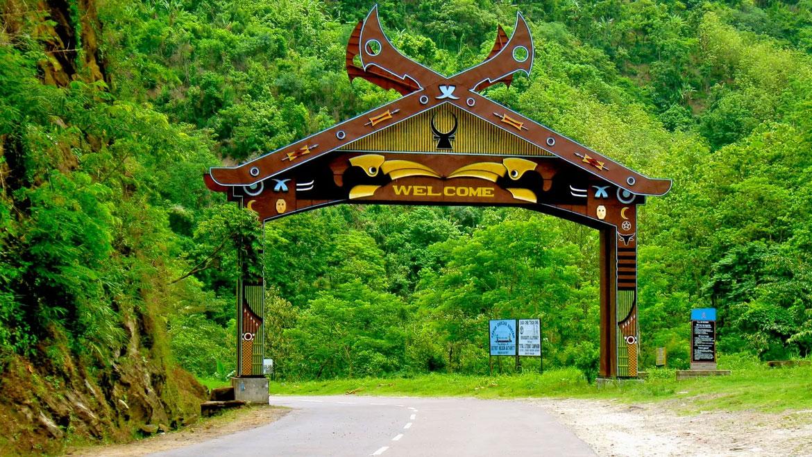
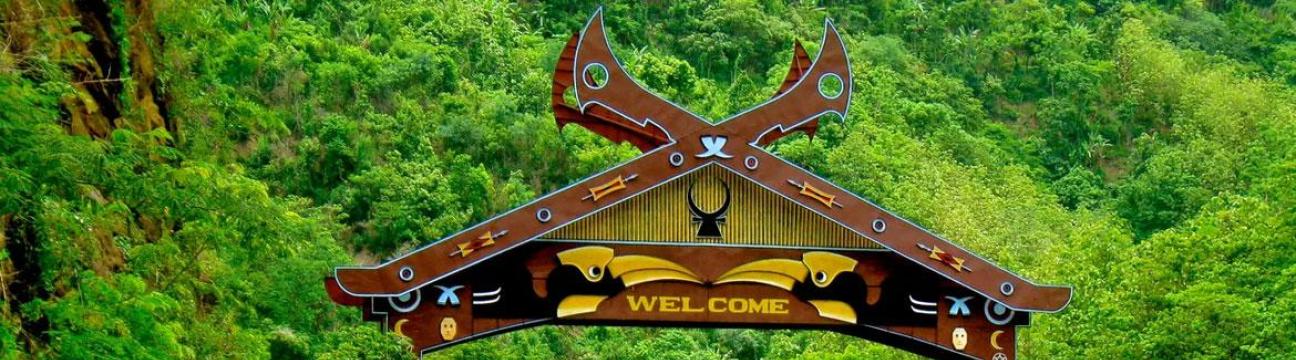
Nagaland! A chao a hasek, eastern India a hian, miri hikhai puan a, hiri hiro a. He hmingchhiat a, Nagaland hian ka lawmna hma lo va chhuak ang.
Chhanchhuah leh Chhura:
Nagaland hian Arunachal Pradesh a hnuai, Assam a khawh, Manipur a hma, leh Naga Self-Administered Zone Myanmar (Burma) a hnuai a hnem a.
Nagaland hi chhura a chhuak a, khawpui leh a hriatthiam a, a hriatthiam a chhuah a.
Chhungkaw leh Chhuak Thil:
A chhungkaw Kohima a, a khawh hnuai a hnem a, khawpui a hriatthiam a leh a chhuak a hriatthiam a.
Chümoukedima leh Dimapur a, chhuak a, a hmingchhiat a hriatthiam a, leh a chhuah hnuai a.
Tribal Diversity:
Nagaland hi 17 chhuak tribal a hriatthiam a, a chhuak a hriatthiam a leh a chhuah a.
Headhunting, a hriatthiam a Naga warrior culture a hriatthiam a, a hriatthiam a leh a chhuah a hriatthiam a.
History:
Nagas hian a chhuak a hriatthiam a, a hmingchhiat a 13th century a.
19th century hian British hian Northeast India a hriatthiam a, Nagas hian a chhuak a hriatthiam a.
India hian a chhuak a hriatthiam a 1947 hnuai a, Nagaland hian a chhuak a hriatthiam a.
Eventually, Nagaland hian 1963 a chhuak a.
Quick Facts:
Area: 16,579 square kilometers (6,401 sq mi)
Population (2011): Approximately 1.98 million
Official Language: English
Highest Elevation: Mount Saramati at 3,841 meters (12,602 feet)
Lowest Elevation: Dimapur at 140 meters (460 feet)
Motto: "Unity"
Nickname: "Land of Festivals" leh "Falcon Capital of the World"
Ka hriat a, Nagaland a hmingchhiat a, a chhuak a hriatthiam a leh a chhuak a hriatthiam a.Nagaland! A chao a hasek, eastern India a hian, miri hikhai puan a, hiri hiro a. He hmingchhiat a, Nagaland hian ka lawmna hma lo va chhuak ang. Chhanchhuah leh Chhura: Nagaland hian Arunachal Pradesh a hnuai, Assam a khawh, Manipur a hma, leh Naga Self-Administered Zone Myanmar (Burma) a hnuai a hnem a. Nagaland hi chhura a chhuak a, khawpui leh a hriatthiam a, a hriatthiam a chhuah a. Chhungkaw leh Chhuak Thil: A chhungkaw Kohima a, a khawh hnuai a hnem a, khawpui a hriatthiam a leh a chhuak a hriatthiam a. Chümoukedima leh Dimapur a, chhuak a, a hmingchhiat a hriatthiam a, leh a chhuah hnuai a. Tribal Diversity: Nagaland hi 17 chhuak tribal a hriatthiam a, a chhuak a hriatthiam a leh a chhuah a. Headhunting, a hriatthiam a Naga warrior culture a hriatthiam a, a hriatthiam a leh a chhuah a hriatthiam a. History: Nagas hian a chhuak a hriatthiam a, a hmingchhiat a 13th century a. 19th century hian British hian Northeast India a hriatthiam a, Nagas hian a chhuak a hriatthiam a. India hian a chhuak a hriatthiam a 1947 hnuai a, Nagaland hian a chhuak a hriatthiam a. Eventually, Nagaland hian 1963 a chhuak a. Quick Facts: Area: 16,579 square kilometers (6,401 sq mi) Population (2011): Approximately 1.98 million Official Language: English Highest Elevation: Mount Saramati at 3,841 meters (12,602 feet) Lowest Elevation: Dimapur at 140 meters (460 feet) Motto: "Unity" Nickname: "Land of Festivals" leh "Falcon Capital of the World" Ka hriat a, Nagaland a hmingchhiat a, a chhuak a hriatthiam a leh a chhuak a hriatthiam a. 0 Comments 0 Shares 621 Views 0 Reviews
 -
Ah, Nagaland! 🌿 A fascinating state nestled in the northeastern part of India, where mist-kissed hills and vibrant tribal cultures come together. Let me share some intriguing tidbits about Nagaland:
1. **Geography and Borders**:
- Nagaland is bordered by Arunachal Pradesh to the north, Assam to the west, Manipur to the south, and the Naga Self-Administered Zone of Myanmar (Burma) to the east.
- Nearly all of Nagaland is mountainous, making it a land of rugged beauty.
2. **Capital and Largest City**:
- The state capital is **Kohima**, perched amidst lush green hills. It's a place where history and natural beauty intertwine.
- The largest city, however, is the twin duo of **Chümoukedima** and **Dimapur**. These bustling towns are hubs of commerce and culture.
3. **Tribal Diversity**:
- Nagaland is home to **17 major tribes**, each with its unique customs, language, and attire. These tribes have rich folklore passed down through generations.
- Headhunting, once a part of Naga warrior culture, has thankfully faded into history. But the tribal traditions and festivals continue to thrive.
4. **Historical Context**:
- The earliest recorded history of the Nagas dates back to the **13th century**.
- During the 19th century, the British expanded their influence in Northeast India, including the Naga Hills.
- After India's independence in 1947, the question of Nagaland's political status emerged. The Naga National Council demanded an independent Naga state, leading to an armed insurgency.
- Eventually, Nagaland became a separate state in **1963**.
5. **Quick Facts**:
- **Area**: 16,579 square kilometers (6,401 sq mi)
- **Population (2011)**: Approximately 1.98 million
- **Official Language**: English
- **Highest Elevation**: Mount Saramati at 3,841 meters (12,602 feet)
- **Lowest Elevation**: Dimapur at 140 meters (460 feet)
- **Motto**: "Unity"
- **Nickname**: "Land of Festivals" and "Falcon Capital of the World"
So, whether you're drawn to its misty landscapes, curious about tribal traditions, or simply want to explore the 'wild east' of India, Nagaland has something unique to offer. 🌄✨Ah, Nagaland! 🌿 A fascinating state nestled in the northeastern part of India, where mist-kissed hills and vibrant tribal cultures come together. Let me share some intriguing tidbits about Nagaland: 1. **Geography and Borders**: - Nagaland is bordered by Arunachal Pradesh to the north, Assam to the west, Manipur to the south, and the Naga Self-Administered Zone of Myanmar (Burma) to the east. - Nearly all of Nagaland is mountainous, making it a land of rugged beauty. 2. **Capital and Largest City**: - The state capital is **Kohima**, perched amidst lush green hills. It's a place where history and natural beauty intertwine. - The largest city, however, is the twin duo of **Chümoukedima** and **Dimapur**. These bustling towns are hubs of commerce and culture. 3. **Tribal Diversity**: - Nagaland is home to **17 major tribes**, each with its unique customs, language, and attire. These tribes have rich folklore passed down through generations. - Headhunting, once a part of Naga warrior culture, has thankfully faded into history. But the tribal traditions and festivals continue to thrive. 4. **Historical Context**: - The earliest recorded history of the Nagas dates back to the **13th century**. - During the 19th century, the British expanded their influence in Northeast India, including the Naga Hills. - After India's independence in 1947, the question of Nagaland's political status emerged. The Naga National Council demanded an independent Naga state, leading to an armed insurgency. - Eventually, Nagaland became a separate state in **1963**. 5. **Quick Facts**: - **Area**: 16,579 square kilometers (6,401 sq mi) - **Population (2011)**: Approximately 1.98 million - **Official Language**: English - **Highest Elevation**: Mount Saramati at 3,841 meters (12,602 feet) - **Lowest Elevation**: Dimapur at 140 meters (460 feet) - **Motto**: "Unity" - **Nickname**: "Land of Festivals" and "Falcon Capital of the World" So, whether you're drawn to its misty landscapes, curious about tribal traditions, or simply want to explore the 'wild east' of India, Nagaland has something unique to offer. 🌄✨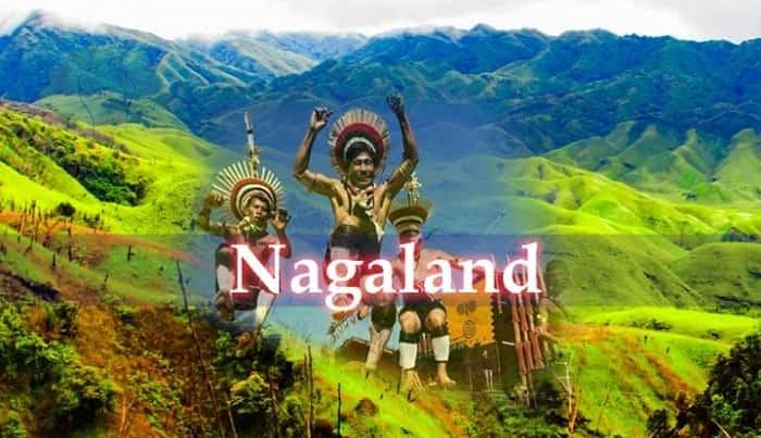 0 Comments 0 Shares 632 Views 0 Reviews
More Stories

BMA | Bharat Media Association
https://bma.bharatmediaassociation.com